In 2000, Argus Properties with the support of the Whitehorse City Council initiated the process of filling in the wetlands with gravel from near the airport. The infill created a platform for the construction of box stores, but eliminated the wet lands and the ecological benefits associated with wetlands. The changes in the biological processes associated with the infill was the focus of ES 11 studies.
The ES 11 study examined the change in the turbidity of Spook Creek where it entered the Yukon River. Students took samples near the start of the infill process using turbidity tubes up stream from the infill, from the wetlands prior to the infill and downstream from the infill.
Report of Water Inspections Officer November 26, 2008 states: "The WUL in effect allowed for the infilling of a wetland and pond, and, re-routing of the creek around the perimeter of a proposed development site. The licence specifically authorized the construction of an open ditch and the proponents stated that the channel would remain open and would re-vegetate naturally to provide habitat for fish and natural filtration for waters in the creek. Recommendations from Water Resources prior to the issuance of the licence specifically asked that, "the licensee ... construct the ditch in such a manner that there is no increase in suspended sediment in the waters of "Spook" Creek, above background (as measured at the Two Mile HW crossing), immediately prior to discharge into the Yukon River. "
In the summary of their report, the Water Inspections Officer makes the following pionts related to the lower reaches of the creerk, the section that was once a wetland.
A further investigation should be initiated looking into the activities of the City of Whitehorse to further altering the lower reach of Spook Creek, by encapsulating the flow within a pipe whereby sediment is transported directly into the Yukon River.
10. Discuss options with the City of Whitehorse of removing pipe from the section of the creek, widening the creek and establishing vegetation to promote natural attenuation.
11. Explore options with City of Whitehorse to construct a sediment basin above Two Mile Hill crossing, across from the cemetery and across form Earls Restaurant.
12. Storm water runoff from Canadian Tire/Wall Mart is also directed into the Yukon River via Spook Creek and should form part of any investigation of the lower reach of Spook Creek.
14. Baxter's Gulch/Spook Creek could be an excellent opportunity for research and or educational study given the extent contamination and disturbance, proximity to research facilities, and its impact on an important aquatic resource- the Yukon River.
15. Study may also provide managers and planners a useful opportunity to examine how not proceed with development- which in this case appears to be in an ad hoc fashion, where the environment is completely set aside or ignored so that development can progress.
The ES 11 class has conducted three studies related to this infill. ES classes have measured turbidity at different locations along the lower reach of Spook Creek between 2006 to 2012 noting increased sedimentation and plant growth ( grasses and sedges) along the ditch lines between Two Mile Hill and Mountain View Drive.
ES classes in 2001 compared the turbidity using turbidity tubes, of Spook Creek and Marwell Creek where they entered the Yukon River. Marwell creek passes through a wet land similar to the lower wetland Spook Creek passed through before entering the Yukon River.They found the wetlands reduced turbidity dramatically.
|
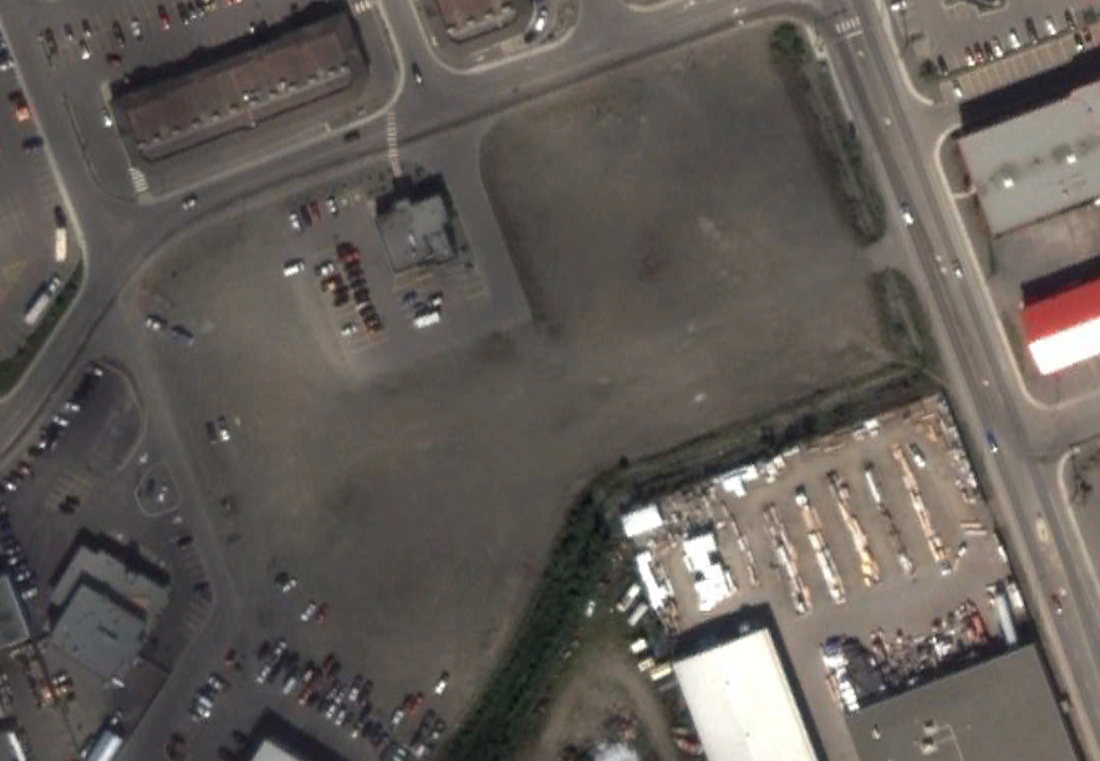
In 2013 ES classes examined the extent to which the infilled wet lands had been used.The image to the right shows the unused infill. Since this photo, Rickys Restaurant has closed at this location leaving this region unused. ES classes observed sweet clover had occupied approximately 40% of the area. The site remained disturbed but unused.
|
|
