|
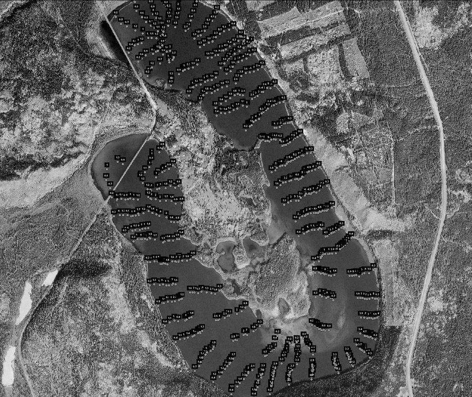
Bathymetry is the study of underwater depth of lake. A bathymetric survey is the underwater equivalent to topography. Bathymetric charts usually show lake bottom relief as depth contours. The mapping of Cowley Lake bottom involved nine canoes, GPS and weighted lines. The canoes spread out from the shoe to approximately the middle of the lake. The canoes move in concert around the lake , taking depth and location measurements about every 100 meters. The waypoints were then converted to the depth recorded and the points were plotted on a Geo-referenced image of Cowley Lake. Approximately 1000 depth points were plotted using this method. The results, shown to the right, revealed a mean depth of 2 meters.
|
|
